

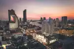





Bangkok makes more sense when you follow its connections: sois, station bridges, river piers and canal routes linking its better-known places.


Introduction
Bangkok does not always yield to the neat logic of a map. A main road slows to a crawl beneath brake lights and traffic; a rail station that looked close to your destination delivers you instead to a broad junction, a covered walkway or a pavement that simply ends. Then, a few minutes later, a narrow lane opens beside a convenience shop and the city shifts scale: woks hissing at a food stall, delivery riders waiting in the shade, a tailor bent over their work, modest homes set behind a busy frontage.
Much of Bangkok’s character lies in these transitions. It is there in the walk from station to soi, the pause at a pier as passengers gather out of the heat, the brief coolness beneath a skywalk, or the glimpse of a canal running behind a commercial street. Landmarks matter, but the routes between them show how the city’s everyday life is joined together.
This is not a guide to secret passages, nor a promise that every apparent shortcut will be straightforward. Bangkok’s streets, walkways and waterways are changeable: access shifts, weather intervenes, and a short line on a map may take longer than it suggests. Think of it instead as a way to read the city through its connections, using the networks that make this large, layered place easier to navigate.

Start with the map, then expect it to change
Bangkok has several overlapping systems. The BTS Skytrain runs above key corridors, its trains gliding past office towers and packed roads, while the MRT serves a different but connected set of areas. Major roads branch into sois, the Thai word generally used for side streets. The Chao Phraya River forms a north-south transport corridor, and canal services connect selected parts of the city on a different scale again.
It is useful to begin with rail. Check BTS route, fare and station-area information and the official MRT route map and station information before setting out, particularly when a journey involves a station exit, transfer or onward walk. A line diagram tells only part of the story. It cannot show how long a crossing feels in heavy rain, whether a particular entrance leads to the side of the road you need, or whether works have altered the pavement.
That final stretch matters. Two places may look close but be separated by a road with few practical crossings, a private development, a canal, or a station whose exits emerge in different directions. Keep a pinned destination and its name available on your phone; having the name in Thai can also be useful when asking for help. Treat a route as a sequence of small decisions rather than a single uninterrupted line.
Rail service hours also set a practical boundary around the day. The BTS states general station, train-service and ticket-office hours of 06:00 to 24:00, though this should not be taken to mean that every linked building, passage or elevated walkway follows the same timetable. Check BTS operating hours and the access arrangements for your particular station rather than relying on an old itinerary.
Bangkok has several overlapping systems. The BTS Skytrain runs above key corridors, its trains gliding past office towers and packed roads, while the MRT serves a different but connected set of areas.

Sois: the side streets that reveal Bangkok
A soi is not simply a shortcut. It can be a local working street, a residential address, a service lane and a small commercial strip at once. Leaving an arterial road often means stepping out of a hard-edged stream of buses and cars into a closer scene: laundries, cafés, pharmacies, repair shops, food stalls and motorbikes easing carefully past pedestrians. The city does not become quiet so much as more intimate; its daily tasks come into view.
Along Sukhumvit, numbered sois provide a loose orientation system, but they are not a uniform grid. One may be broad, busy and lined with businesses; another may narrow sharply, bend unexpectedly or lead into a residential compound. A stretch of shade can give way to a sun-baked pavement, while a promising line on a map may end at a gate, a construction barrier or a road that is less comfortable to cross than it first appeared. Ongoing improvement work in parts of the city is another reason to expect conditions to differ from a map or an earlier review.
The best use of a soi is often modest. It may provide a calmer walk between a station and a hotel, a place to buy water before a longer journey, or a brief alternative to waiting beside a loud main road. It can also make a neighbourhood easier to read: the morning deliveries, the lunchtime trade, the repair work, the small services that support the larger commercial corridors nearby.
Use judgement. Choose routes that are clearly public and well used, particularly if you are unfamiliar with the area. Do not assume that a lane shown on a digital map passes through, and do not cut through private compounds simply because the route appears shorter. After dark, a direct main-road or station route is often the better choice. In heat or rain, the slower path with shade, a covered stop or an obvious crossing may be more sensible than the nominally quickest one.
Skywalks and station bridges: above the traffic, not outside the city
Bangkok’s elevated pedestrian routes can feel like a brief second city suspended above the traffic. From a station bridge or skywalk, queues gather at kerbs below, rain stipples the carriageway, office workers move with purpose and signs compete for attention. In central districts, where BTS stations connect to footbridges, malls and individual buildings, these links can take some of the strain out of crossing major roads.
But the important word is individual. Bangkok has no single, continuous public skywalk network. Some connections belong to particular buildings, some have restricted access, and others are being developed or operate under changing arrangements. The BMA, for example, identifies the Siam–Chit Lom skywalk connection as an access route for a CentralWorld service point. That is useful locally, but it is not evidence of a citywide route.
Use elevated links as practical tools rather than destinations in themselves. They can make a midday walk more manageable, remove one awkward crossing or offer partial cover during a shower. Still, check where you will return to street level. A walkway may finish at a building entrance, an exit may be closed, and the final few hundred metres may involve stairs or uneven pavement.
This changing quality is part of the infrastructure itself. The BMA records BMA skywalk project updates for a connection at Bang Wa, a reminder that these pedestrian links are evolving parts of the transport system, not fixed features on a map. Travellers with pushchairs, heavy luggage or mobility requirements should be particularly careful not to assume lift access or step-free continuity, and should check the relevant station and destination on the day.
The river: a moving corridor with its own timetable
The Chao Phraya is one of Bangkok’s clearest lines of orientation. From the water, bridges, piers, hotel towers, warehouses, shrines and riverside housing pass in a sequence that makes the city easier to read. But this is not simply a scenic diversion: it is a working public-transport corridor, carrying people between districts every day.
Public boat lines and cross-river ferries connect parts of the riverside, though services vary by route, day and time. At the pier, the task is simple but demands attention: identify the right boat, watch for destination information, allow passengers to disembark, then board carefully when directed. Piers can be busy and the boats do not linger; a crossing may feel brisk, especially when the river is moving and passengers are travelling with purpose.
Before setting out, consult the operator’s current Chao Phraya Express Boat routes and timetable. Its published information distinguishes several lines with different service patterns and notes that Oriental Pier (N1) is closed for renovation. Details like these can quickly turn an assured-looking plan into a detour, so check close to departure.
Once afloat, the river can reset your sense of distance. Unlike a taxi journey through traffic, it offers a broad view of how neighbourhoods sit alongside one another. That does not make it quiet or leisurely: boats may be crowded, warm and noisy, and they will not suit every traveller or every weather condition. Their value is simpler and more useful than that: the river is another practical line through Bangkok.
Khlongs: routes where the city narrows
Bangkok’s khlongs, or canals, offer travel on a closer, more intimate scale. The Khlong Saen Saep passenger service runs between Wat Si Bun Rueang and Phan Fa Lilat, calling at stops including Asok, Nana Nua, Pratunam and Phan Fa Lilat. This is a working transport route serving particular parts of the city, rather than a universal visitor circuit.
The view is different from the river’s broad sweep. Along the canal, Bangkok passes at close quarters: rear walls, workshops, temples, homes, small bridges and the practical infrastructure that keeps the city moving. These are lived and working spaces, not a backdrop for intrusion. Keep cameras and curiosity respectful, and remember that the boat is chiefly carrying people through their everyday journeys.
Canal travel is most useful when it genuinely fits your route. One verified connection begins at Phetchaburi MRT: official station information lists Exit 2 for Asoke Montri Road, Asoke Pier and Asok Bridge Pier. Review Phetchaburi MRT connections to Asoke Pier before deciding whether the onward walk suits your plans. Lifts, escalators and ramps at listed station exits are useful details, but they do not guarantee that the full onward route will be step-free.
Services, fares, operating hours and temporary changes need local confirmation. The Marine Department’s resources are a useful place to check current Saen Saep service information, but also confirm details at the pier or with your accommodation team on the day. Board carefully, keep belongings secure and expect the occasional spray. For a time-sensitive reservation, do not make a canal journey your only way there.
Build a day around connections, not just pins
A well-connected day in Bangkok does not need to use every mode of transport. More often, it works best when one or two systems provide the structure and the space between them is left open for the city itself.
- Sukhumvit by rail and soi: Let the BTS or MRT form the day’s spine, then make time for one or two well-used sois near a chosen stop. Rather than trying to cover the whole corridor, give the walk a purpose: a meal, gallery, shop or appointment.
- Rail to river: Take rail to a suitable interchange or riverside area, then use a verified boat service for one stretch of the Chao Phraya. Keep the return journey straightforward, and confirm pier status before you set off.
- Central Bangkok by MRT and canal: Begin on the MRT, assess the walk from Phetchaburi towards the Asoke canal piers, and take the boat only when current local information shows that it suits your destination and timing.
In each case, choose one fixed point and let the rest remain flexible. A museum booking, lunch reservation or evening plan gives the day an anchor; the walk to and from it brings the texture. Leave room for a wrong turn, a long station passage, a sudden shower, or a stall, side street or canal-side view that proves more compelling than the place you first pinned.
When not to take the shortcut
There is no prize for making a journey more complicated than it needs to be. After dark, leave an unfamiliar or poorly lit passage for another time if a busier road or station exit is available. A narrow lane that looks manageable on a map may be awkward with luggage or a pushchair. For travellers with young children, mobility needs or several bags, fewer changes, clearer surfaces and a reliable route can matter more than saving a few minutes.
Weather and conditions reshape the city’s logic, too. Before a day built around walking, check the official forecast on the day. In heavy rain, consult Bangkok’s live road-flood monitor if standing water could affect your route. Heat, rain and air quality are not reasons to write off the city; they are part of the day’s practical texture, making shade, rail travel, indoor pauses and a less ambitious walking plan the wiser choice.
When in doubt, ask. Station staff, pier personnel and accommodation teams may know that an exit has closed, a boarding point has moved or a road is easier to cross elsewhere. Their current local advice is often more useful than a route suggestion published months earlier.
Learn the joins and Bangkok opens up
Bangkok rewards travellers who pay attention to its joins. The shift from an elevated platform to the pavement, from pavement to soi, road to pier, and river to another district can become part of the day rather than a delay between sights. These small transitions are where the city’s rhythms become clearest.
Move with curiosity, but do not feel obliged to turn every lane or waterway into a discovery. Take the route that works in the moment, allow for a change of plan, and let Bangkok reveal itself through its ordinary connections. When choosing where to stay, browsing serviced accommodation in Bangkok can also help you weigh up the rail, river and neighbourhood links that suit the kind of days you hope to have.